This walk was organised and led by Ian S as a CBC walk:
(Saturday 26 August- Namadgi N.P.- M/R Route: From Rendezvous Creek car park we値l ascend the ridge above its true left bank, climb through the boulders to .1342 and beyond to a point somewhere along the ridgeline from whence we値l descend to return along Rendezvous Creek. Maps: Rendezvous Creek 1:25,000 Leader: Ian S. Transport: c$10.00). 4 of us drove south along the Boboyan Road to the Rendezvous Creek car park, a few hundred metres after the road crosses Rendezvous Creek. The couple of metres of dirt road up to the car park is pretty rugged; wouldn't like to do it in a car. |
It was a lovely day, not a breath of breeze and the sky was blue. We set out up the road just before 9am, heading cross country at the first bend. A creamy-white wild dog trotted across out path and headed down towards the creek. We jumped across Rendezvous Creek and headed into the trees and up the ridge. Pretty easy walking and by 10am we were well up the ridge towards the first Spot Height. Excellent views began to open up - a snow-dusted Booths Hill to the E and the Gudgenby grasslands leading into the wide mouth area of Rendezvous Creek to the SW and S. A wedge-tailed eagle soared effortlessly in the distance.
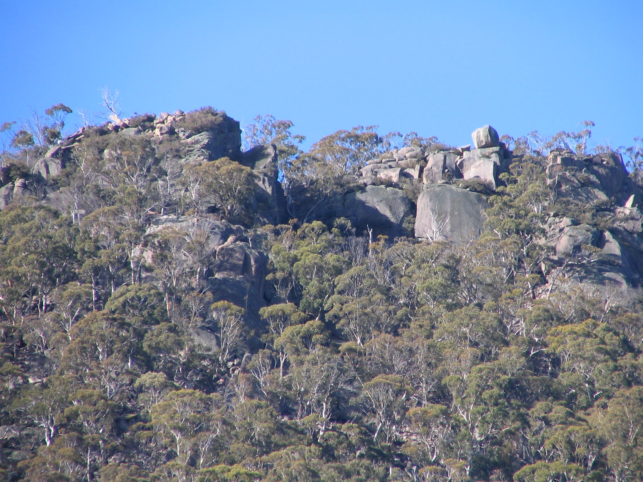
Morning tea was taken at 10.40am, just shy of SH 1342. 2 black cockatoos loped over. The grassland view had opened up even more (see pic 1). I spend some time gazing NW and SW, checking out views to the Mavis Ridge (a walk there on 23 September) and the ridge NW of Yankee Hat South (heading that way next Tuesday). On up to SH 1342 for more grand views (see pic 2).
The ridge NW from here to lunch was a lovely series of granite knolls and surprisingly open, dry woodland, relatively unburnt. Although the fire had been through, the hardenbergia has responded excellently - I have never seen such large areas of the plants. A few early flowers were out. Jenny told me of the unique form of grevillia in the area (Max and I had seen it last Tuesday), particular to the Booth Range and surrounds. She said some years ago Murray Dow had led a walk with objective to appreciate this plant. Great views at the clearer knolls both left and right.
One of our party was a little off-colour, so we dropped anchor at 12.15pm on the middle of 3 prominent knolls, about half way between SH 1342 and SH 1403. A lazy lunch, enjoying more views down to Mt Gudgenby and N up the Mavis ridge to Mt Herlt and Mt Mavis. A stove appeared and water was heated for all.
Tracking SW took us down off the ridge to the open creek floor. Lyrebirds called in the bush. We enjoyed a wander SE back down the creek, with views up to our inward leg (pic 3).
Kangaroos barely lifted their heads as we strolled past and we were soon back to the car.
A nice little walk. A lovely ridgeline (not as scrubby as last Tuesday's NE of Nursery Swamp) with a nice mixture of granite knolls with views and open woodland. Only a little scrub and regrowth. Thanks Ian for getting us there, and to Sandy and Jenny for a heap of flora info and company.
Distance: 8.7km Climb: 400m. Time: 8.55am - 3.30pm (call it 6.5hrs), with 1hr 25mins of breaks.