| Site |
Description and Location
(from Sites of
Significance in the ACT) |
Visited
(click on the link below for a walk report) |
Pic
(click on the thumbnail below for a larger photo) |
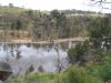
| B4 |
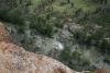
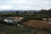
Ginninderra Creek - Macgregor |
25 Jul 10* |
 |
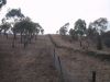
| B5 |
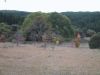
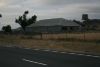
Axe-Grinding Grooves - Latham |
25 Jul 10* |
 |
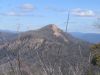
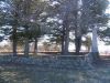
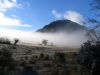
| B11 |
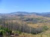
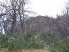
Mt Painter |
20 Jul 09* |
 |
| G1 |
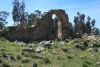
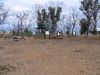
Honeysuckle Creek Swamp - Near western end of the swamp on Honeysuckle Creek, just west of the road to Booroomba Rocks |
29 Jul 08* |
 |
 |
| G2 |
Rock Flats - About 4km west of the Lunar Laser Ranger station at the head of Rendezvous Creek and on the divide with the Cotter catchment |
21 Jun 08
13 Nov 07*
27 Mar 07 |
 |
| G3 |
Mt Orroral - Approximately 5km east of Cotter Flat, forming the headwaters of Rendezvous Creek |
21 Nov 06*
9 Aug 06
22 Oct 05
20 Aug 05 |
 |
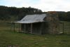
| G4 |
Rollys Hut (Rowley's Orroral Hut) - In the Orroral valley 2km north-west of Orroral Tracking Station (burnt) |
1-4 Oct 10
23 Jun 09
27 May 08
10 Apr 07*
7 Apr 07 |
 |
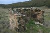
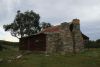
| G5 |
Orroral Homestead - Southern side of Orroral valley 1km south-east of the Orroral Tracking Station and 500m west of the Orroral River |
27 May 08
10 Apr 07
9 Jun 03* |
 |
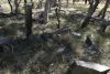
| G6 |
Old Orroral Homestead - Approximately 120m south-east of Orroral Homestead |
27 May 08*
29 Apr 08 |
_t.jpg) |
| G7 |
Nursery Swamp - Approximately 4km west of the Namadgi National Park Headquarters at Glendale Crossing |
16 Jan 08
2 Apr 05
11 Jan 03* |
 |
| G8 |
Additional material available via password |
| G9 |
Rowley's Rendezvous Creek Hut - 4km north-west of Gudgenby Station on the walking track to Rendezvous Creek art site |
8 Sep 09
14 Aug 07
12 Oct 05* |
 |
| G11 |
Glendale Geological Site - Road cutting 3km south of the Glendale Depot of Namadgi National Park |
5 Apr 08* |
 |
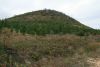
| G16 |
Mt Gudgenby - Approximately 8km south-west of Gudgenby Homestead, near the headwaters of Naas Creek |
30Sep-2Oct 06*
12 Nov 05 |
 |
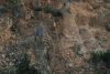
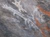
| G17 |
Yankee Hat Archaeological Site - The sites lie on the lower eastern slopes of Yankee Hat mountain at an elevation around 100m and is in the shelter of two boulders of Shannons Flat Adamellite |
22 Jul 08*
26 Mar 05
5 Feb 05
24 Nov 04
10 Jul 04* |
 |
 |
| G18 |
Bogong Creek Swamp - Between the Old Boboyan Road and Yankee Hat, and surrounded by Gudgenby Pine Plantation |
25 Aug 09
22 Jul 08*
5 Apr 08
12 Nov 05
10 Jul 04
others |
 |
| G19 |
Gudgenby Station - Western side of Gudgenby River near junction of Hospital Creek |
22 Jul 08* |
 |
| G20 |
Frank Oldfields Pines Hut (Frank and Jack's Hut) - 500m west of the Old Boboyan Road 5km south-west of Gudgenby Station |
22 Jul 08
1 Jul 08
12 Nov 05*
16 Oct 04 |
 |
| G21 |
Oldfields Hospital Creek Hut - Headwaters of Hospital Creek about 400m east of the Old Boboyan Road |
9 Mar 10
16 Jun 09
1 Jul 08
21 Jun 06* |
 |
| G22 |
Hospital Hill - North-south trending ridge 1km west of the Boboyan Road and 6km south of the Gudgenby River crossing |
21 Jun 06* |
 |
| G24 |
Naas River Gorge - Naas River channel and lower valley-side slopes commencing about 800m north of the junction of Naas River and Reedy Creek and extending for approximately 1.5km along the valley |
3 Jul 07 |
No pic available |
| G26 |
Horse Gully Hut - Adjacent to the Naas River fire trail 8km north-east of the Mt Clear campground |
27 Oct 09
29 Jan 09
13 Mar 07* |
 |
| G27 |
Curtis Refuge Hut (Demandering Hut) - 200m west of the Naas River fire trail and 6km north-east of the Mt Clear campground |
27 Oct 09
13 Mar 07* |
 |
| G28 |
Left Hand Creek - massive aplite dyke forming a knick in the creek |
27 Oct 09* |
 |
| G31 |
Upper Naas Creek Valley - Site 2 - Downstream from the junction of Sheep Station Creek near the crossing of the Naas Creek by the Old Boboyan Road |
24 Jun 08
18 Mar 08* |
 |
| G32 |
Sheep Station Creek Fence - Valley of Sheep Station Creek 1km west of the junction with Naas Creek |
18 Mar 08* |
 |
| G33 |
Sentry Box Mountain - At the southern end of the Scabby Range, on the south west border of the ACT |
28 Nov 06*
3-4 Jul 04 |
 |
| G34 |
Lonesom Pine Homestead Ruin - Beside Sheep Station Creek 2km west of the Naas River |
18 Mar 08*
3-4 Jul 04 |
 |
| G35 |
Boboyan Trackway |
24 Jun 08 |
not properly identified |
| G37 |
Boboyan Homestead complex - Beside Old Boboyan Road 2.5km north-west of the junction with the Boboyan Road |
24 Jun 08*
18 Mar 08
25 Apr 07*
2 Oct 04
3-4 Jul 04 |
 |
 |
| G38 |
Grassy Creek Hut (Waterhole Hut) - Valley of Grassy Creek 4km north-west of Westermans Homestead |
13 Apr 10
24 Jun 08
18 Mar 08
8 May 07*
3-4 Jul 04 |
 |
| G39 |
Grassy Creek Sheepyards (under Pheasant Hill) - Northern side of Grassy Creek on the south-western slopes of Pheasant Hill 1.5km north-west of Westermans Hut |
24 Jun 08
18 Mar 08* |
 |
| G40 |
Brayshaws Hut - Beside the Boboyan Road 2km north of the ACT-NSW border |
24 Jun 08
18 Mar 08
8 May 07* |
 |
| G41 |
Tin Dish School - About 100m south east of the Boboyan Road opposite Brayshaws Hut |
24 Jun 08
18 Mar 08* |
 |
| G42 |
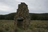
Grassy Creek Hut Site (Charles Potters) (Potters Chimney) - Northern side of Grassy Creek 800m upstream (south) of the junction with Naas Creek |
25 Jul 09
8 May 07*
13 Mar 07 |
 |
| G43 |
Grassy Creek Tussock Grasslands |
25 Jul 09 |
|
| G44 |
Westermans Homestead - Southern side of Grassy Creek 1km north-west of the Boboyan Road and the ACT-NSW border |
13 Apr 10
24 Jun 08
18 Mar 08
8 May 07*
2 Oct 04 |
 |
| G45 |
Border Basalt Geological and Historical Site - Small plateau on the ACT-NSW border 2km west of the Boboyan Road |
13 Apr 10
24 Jun 08* |
 |
| G46 |
Border Fault Quartz Geological Site - 1km due west of the Boboyan Road on the ACT-NSW border |
24 Jun 08* |
 |
| G47 |
Mt Clear Hut Site (Chalkers Chimney) - Beside a small tributary of Naas Creek approximately 2km south-west of Mt Clear and 2km north of Top Flats |
25 Jul 09
8 May 07* |
 |
| G48 |
Long Flat - Near the southern border of the ACT, south-west of Mt Clear |
14 Sep 05* |
 |
| GH10 |
Percival Hill |
25 Oct 09* |
 |
| GH13 |
Mulligans Flat Woodland |
28 Jul 09
18 Jan 07* |
 |
| GH14 |
Thomas Gribble's Home (The Valley) - Near Gundaroo Road, north of Gungahlin Hill |
13 Jan 09*
just drove past |
_t.jpg) |
| GH18 |
ACT Border Marker - Gungahlin - X4 peg there, 13 Mile marker gone |
1 Jan 10* |
 |
| GH19 |
Gungahlin Hill |
27 Sep 09* |
 |
| GH24 |
Gungahlin Quartz Ridge |
28 Jul 09* |
 |
| J1 |
Mugga Mugga Historic House - S of Hindmarch Drive, E of Mt Mugga Mugga |
1 Mar 09*
visited with Gay $5pp guided tour |
 |
| K1 |
Glen Burn Creek - Historic Site A Homestead B Graves C Woolshed - Valley of Glen Burn Creek 4km east of Kowen Forestry Settlement, Kowen Forest |
24 Mar 08
29 Jan 08* |
 |
 |
 |
| K3 |
Molonglo Gorge - East of Sutton Road between ACT border and Kowen Forest |
29 Jan 08* |
 |
| K5 |
William Colliers Homestead - Molonglo River - North bank of Molonglo River in Kowen Forest |
29 Jan 08* |
 |
| LBG15 |
Jerrabomberra Wetlands |
16 Mar 09* |
 |
| LC1 |
Mt Coree - Northern Brindabella Range on the north eastern edge of the ACT |
2 Sep 08
19 Feb 05 |
 |
| LC2 |
Blundells Flat and Blundells Farm Arboretum - Within the Valley of Condor Creek in Uriarra Forest |
2 Sep 08
26 Aug 08*
19 Feb 05 |
 |
| LC3 |
Mt Blundell Area - Northern Brindabella Range, spanning the ACT border |
18 Nov 08
26 Aug 08* |
 |
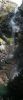
| LC7 |
Sugarloaf Hill - West of Paddys River Road, in Pierces Creek Forest |
19 Apr 08* |
 |
| LC13 |
Pierces Creek Falls - Pierces Creek Valley, below the Hardy Range |
11 Aug 07* |
 |
| M10 |
The Oaks - Western end of Oaks Estate |
10 Jun 08* |
 |
| NC1 |
Black Mountain and Aranda Hill - Bounded by Belconnen Way, Barry Drive, Parkes Way, and including the area of Aranda Hill (Kier trig point) |
30 Aug 08*
12 Aug 08
4 Aug 08
19 Sep 03 |
 |
| NC6 |
GlenLoch Cork Oak Plantation - Adjacent to the Glenloch interchange |
30 Aug 08*
4 Aug 08
|
 |
| PT1 |
Cotter Caves Area - Ridge south of Paddys River 500m upstream from junction with the Cotter River |
19 Apr 08*
16 Feb 05 |
 |
| PT2 |
Paddys River Mine Area - Eastern side of Paddys River on spur from Bullen Range |
6 May 08* |
 |
| PT4 |
Wet Gully - Oakey Creek - Valley of Oakey Creek extending into pine plantation |
20 May 08* |
 |
| PT5 |
Nildesperandum (Hurdle Creek) - 2km northest of Tidbinbilla Homestead |
27 Sep 08
5 Dec 06* |
 |
| PT7 |
Jacks Lookout |
6 Jul 10* |
 |
| PT9 |
Homestead Ruin and Well - Tidbinbilla (John Owens) |
6 Jul 10* |
_t.jpg) |
| PT11 |
Pise Ruin, 'Calvary' - Larrys Creek, at foot of Bullen Range |
4 Aug 07* |
 |
| PT12 |
Additional material available via password |
| PT13 |
Gibraltar Peak - North west of Corin Road and east of Tidbinbilla |
1 May 07
15 Oct 05* |
 |
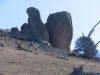
| PT14 |
Mushroom Rock - A group of large boulders or tors of Shannons Flat Adamellite are clustered at the summit of a small hill at the end of a ridge near Gibraltar Peak |
1 May 07* |
 |
| PT16 |
Smokers Flat - 1km south of Smokers Gap |
4 Mar 08
24 Nov 07
13 Jun 07
6 Jan 07
18 Jan 06
5 Jun 05
4 Oct 04
22 Sep 04
18 Aug 04*
12 Apr 04 |
 |
| PT17 |
Gibraltar Falls and Gorge - 10km north east of Corin Dam |
3 Feb 09
12 Apr 04* |
 |
| PT20 |
Blythburn Cottage - Approximately 10km northwest of Tharwa and 2km south of Booroomba Homestead |
19 Feb 08
17 Jul 07* |
 |
| PT21 |
Blue Gum Creek - Headwaters of Paddys River, extending west from Mt Tennent |
6 Jan09
28 Oct 08
19 Feb 08* |
 |
| PT22 |
Mt Tennent Area - South west of Tharwa |
8 Sep 09
16 Dec 08
27 Dec 07*
31 Jul 07
21 Oct 05
15 Mar 04 |
 |
| RR2 |
Rob Roy Range - Between Tuggeranong and the Monaro Highway |
4 Aug 09
9 Sep 06
8 Feb 06* |
 |
| RR5 |
Mt Gigerline Escarpment |
4 Aug 09* |
 |
| RR8 |
Guises Creek and Murrumbidgee River Gorges |
4 Aug 09* |
 |
| SU5 |
Sturt Island - Near the confluence of Murrumbidgee and Molonglo Rivers |
4 Dec 07
17 Jan 04 |
No pic available |
| SU6 |
Murrumbidgee River Bluffs - near Molonglo Confluence (Shepherds Lookout) - Immediately below the Lower Molonglo Water Quality Control Centre (LMWQCC) |
17 Jan 04* |
 |
| SU14 |
Lower Molonglo Gorge - Molonglo River 1-2km upstream from the Lower Molonglo Water Quality Control Centre |
30 Aug 08
4 Aug 08
4 Dec 07* |
 |
| SU15 |
Sherwood Homestead - East of the Blue Range portion of Uriarra Forest |
29 Apr 01* |
 |
| SU19 |
Bluffs and Terraces - Molonglo River - Molonglo River, approximately 1km downstream of Coppins Crossing |
30 Aug 08
4 Aug 08
4 Dec 07 |
No pic available |
| SU21 |
Yarralumla Woolshed Complex - North of Cotter Road near Yarralumla Creek |
13 Aug 05 |
No pic available |
| SU22 |
Cotter Pumping Station - Murrumbidgee River/Cotter River confluence |
23 Dec 05*
30 Nov 05
16 Feb 05
12 Jun 04 |
 |
| SU23 |
Historic Ruins - Greenhills (Richard Moore's stone house site) - Near the Greenhills Camp and Conference Centre (Cottermouth) |
27 Sep 08* |
 |
| SU27 |
Mt Stromlo Observatory Buildings - Mt Stromlo summit |
26 Jul 08* |
 |
| T1 |
Red Rocks Gorge - Murrumbidgee River between Kambah Pool and Tuggeranong Creek |
24 Jan 09
4 Dec 04*
15 May 04 |
 |
| T5 |
Pine Island Area - In the vicinity of Pine Island picnic areas, extending down towards Tuggeranong Creek |
9 Sep 06
26 Dec 05 |
No pic available |
| T7 |
Boundary Marker Complex - Tuggeranong - North of Pine Island near Tuggeranong Creek and extending from the Murrumbidgee River to Drakeford Drive |
7 Feb 09
9 Sep 06
15 May 04* |
 |
| T10 |
Wanniassa Hill Woodland - Crest of Wanniassa Hill |
17 Feb 09
9 Sep 06 |
No pic available |
| T11 |
Rose Cottage - Near Monaro Highway/Isabella Drive intersection |
9 Sep 06 |
No pic available |
| T18 |
Additional material available via password |
| T20 |
Tuggeranong Hill - North east of Tharwa Road, and surrounded by the new suburbs of Theodore and Calwell |
3 Jan 09* |
 |
| T25 |
Lambrigg Homestead Complex - 1km east of Tidbinbilla Road |
4 Nov 07
9 Jan 07
12 Aug 06* |
 |
| T28 |
Castle Hill - Between Tidbinbilla and Booroomba Roads |
6 Aug 06*
11 Sep 05 |
 |
| T32 |
Tharwa Bridge - Murrumbidgee River near Tharwa Village |
22 May 07* |
 |
| T37 |
Gudgenby Confluence - Confluence of Murrumbidgee and Gudgenby Rivers, south of Tharwa |
4 Aug 09*
22 May 07
4 Nov 07 |
 |
| T38 |
Cuppacumbalong Woolshed Complex - South of Tharwa, near the Gudgenby River |
9 Jun 08 |
 |
| UC1 |
Mt Aggie Geological Site - Summit and upper slopes of Mt Aggie in the Brindabella Range above Mt Franklin Road |
15 Mar 06* |
 |
| UC2 |
Mt Franklin Chalet - In the Brindabella Range 1km southwest of the summit of Mt Franklin on the ACT/NSW border (burnt 2003) |
15 Oct 08
6 Nov 07
17 Apr 07
15 Mar 06* |
 |
| UC3 |
Mt Franklin - Eastern Slopes - On the eastern slopes of Brindabella Range from summit of Mt Franklin to Ginini Falls |
6 Nov 07*
17 Apr 07 |
 |
| UC4 |
Ginini Falls - The falls are on the Ginini Creek 600m upstream of Stockyard Creek and 3km southeast of the summit of Mt Franklin |
17 Apr 07*
1 Mar 06 |
 |
| UC5 |
Ginini Flats - Cheyenne Flats - Morass Flats - North-east and east of Mt Ginini, in the southern Brindabella Range |
31 Jan 09
1 Mar 06* |
 |
| UC6 |
Mt Gingera and Snowy Flats - The summit and higher ridges of Mt Gingera and flats at the head of Snowy Flat Creek, in the southern Brindabella Range, 6km southwest of Corin Dam wall |
21 Mar 09
17 Mar 09
9-10 Jan 09*
3 Jun 08
4 Jul 06
25 May 05* |
 |
 |
| UC7 |
White Sands Creek Ridge - Ridges and valley slopes of White Sands Creek and Cotter River, 2km north east of Corin Dam |
4 Nov 08* |
 |
| UC8 |
Corin Dam Geological Site - Rock exposures in road cuttings immediately east, and in the western abutment of Corin Dam |
3 Jun 08 |
 |
| UC9 |
Mt McKeahnie - Summit and southern ridge of Mt McKeahnie and upper valley of Dry Creek. 6km southeast of Corin Dam wall and 2-3km north of 'Eighty Acres', Cotter Hut Road |
3-4 Jun 06* |
 |
| UC11 |
Leura Gap and Rolling Ground Gap - Two locations in the Brindabella Range bewteen Mt Bimberi and Mt Gingera |
9-10 Jan 09* |
 |
 |
| UC12 |
McKeahnie Creek Alpine Ash - In the Brindabella-Bimberi Range adjacent to the Mt Franklin Rd, between Mosquito Creek and McKeahnie Creek 4km NE of Cotter Flats |
9-10 Jan 09* |
 |
| UC14 |
Upper Cotter River - The Cotter River channel upstream from the impoundment limit of Corin Dam and extending to the upper Cotter Falls |
9-10 Jan 09
8 Nov 08*
7-8 Jun 08 |
 |
| UC15 |
Black Sallee Flat - Upper Cotter River valley between De Salis Creek and Cotter Flats |
9-10 Jan 09
3 Oct 05* |
 |
| UC16 |
Cotter Flats - Terraces and floodplain of upper Cotter River immediately downstream of the Cotter Hut |
1-4 Oct 10
9-10 Jan 09
8 Nov 08
7-8 Jun 08*
12-14 Sep 06
3 Oct 05 |
 |
| UC17 |
Upper Cotter Flats - Floodplain and terraces of the upper Cotter River 3km upstream from Cotter Hut near junction with Jacks Creek |
7-8 Jun 08* |
 |
| UC19 |
Licking Hole Creek Quartz Ridge - Valley of Licking Hole Creek 1km southeast of Cotter Hut |
7-8 Jun 08* |
 |
| UC20 |
Coronet Peak - 2km east of Cotter Hut in the upper Cotter valley |
11 Aug 09
30 Oct 07
5-6 Nov 05* |
 |
| UC21 |
Mt Murray - Murrays Gap - Mt Bimberi - A section of the Bimberi Range in the south western section of the upper Cotter catchment |
1-4 Oct 10
12-14 Sep 06*
8-9 Apr 06 |
 |
| UC24 |
Rolleys Flats - Flats and lower valley side slopes adjacent to Cotter River near Porcupine Creek junction 5km south of Cotter Hut |
7-8 Jun 08* |
 |
| UC25 |
Upper Cotter Falls - Cotter River valley 6.5km south of Cotter Hut and at the head of Rolleys Flat |
7-8 Jun 08* |
 |
| UC26 |
Big Creamy Flats - The site includes the headwaters of Creamy Flats Creek, approximately 1.5km northeast of Namadgi Peak |
10 Nov 07
10 Apr 07
10-11 Jun 06*
30Sep-2Oct 06 |
 |
| UC27 |
Mt Namadgi - 2km northeast of Mt Kelly as the culmination of a ridge separating Licking Hole Creek and Creamy Flats Creek |
7 Nov 09
7 Nov 08
10 Nov 07
30Sep-2Oct 06* |
 |
| UC28 |
Additional material available via password |
| UC30 |
Rotten Swamp - Includes the headwaters of Licking Hole Creek approximately 1km northeast of Mt Kelly |
30Sep-2Oct 06
22-24 Apr 06*
2-3 Jan 06 |
 |
| UC31 |
Mt Kelly and Kelly Spur - In the south-eastern part of the Upper Cotter catchment |
15 Dec 07
21-22 Jul 07
9-11 Dec 06
8-9 Jul 06
22-24 Apr 06*
2-3 Jan 06 |
 |
| UC32 |
Scabby Range Lake - Saddle in Scabby Range 2.5km north of Mt Scabby on eastern side of Cotter catchment divide with Sams Creek |
15 Apr 08*
8-9 Jul 06 |
 |
| UC33 |
Mt Scabby and Upper Cotter Basin - In the Scabby Range which lies at the extreme southern end of the Cotter Valley, enclosing the source and headwaters of the Cotter River |
7-8 Jun 08
15 Apr 08*
8-9 Jul 06 |
 |
| WW3 |
Stanley Hill |
17 Feb 09
13 Aug 05 |
No pic |