I don't know whether it's complete.
| Site |
Description
(where no source quoted, from W-G ref1) |
Map (1:25000) |
W-G ref1 |
SoS ref3 |
KHA
ref |
Date Visited2 |
Photo
Click on a thumbnail below to see the full sized picture |
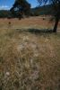
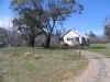
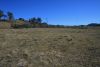
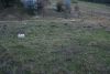
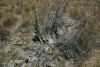
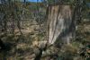
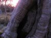
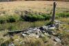
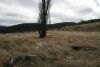
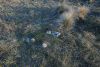
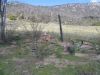
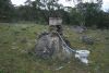
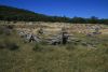
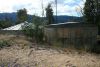
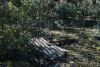
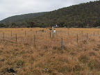
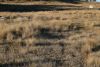
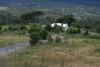
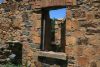
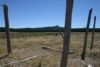
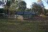
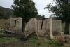
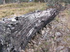
| Alexander Brayshaw's hut (1879) site |
House valued at £45 for Alexander Brayshaw in 1879. (Source: W-G) |
Yaouk |
B6 |
|
314 |
31Aug-1Sep 13
27 Sep 11
3 Sep 11
19 Jul 11
18 Mar 08* |
 |
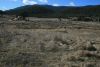
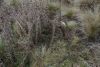
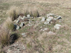
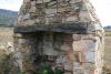
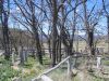
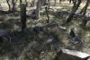
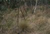
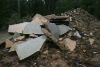
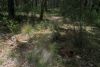
| Alex Brayshaw's Hut (1883) site |
Another vestigial site, this place was valued at 35 pounds in 1883 when surveyed for Alexander Brayshaw. An archaeological survey reported evidence of a vegetable garden at this site. (Source: KHA database)
"ALEXANDER BRAYSHAW'S HUT AND GARDEN Located at grid reference: 677879 East, 6031830 North Alexander (Alex) was renowned for his skill with his bullock team. He won the best working bullock team at the Cooma show quite a few years in a row. He died one week after his daughter Vida from Scarlet Fever. This happened on 23 February of 1919, Sixth son ninth child. He had two sites this one and one further up the valley. (Source: Steve Brayshaw's paper). |
Yaouk |
B5 |
|
315 |
5 Mar 11* |
 |
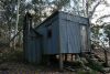
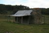
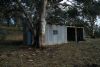
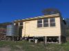
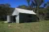
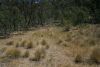
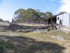
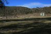
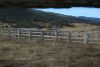
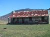
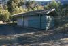
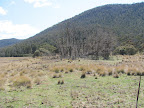
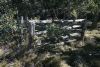
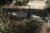
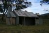
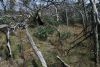
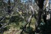
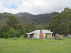
| The Banks Hut (aka Max and Berts (Oldfield) Hut) |
The original Banks Hut was used by Ted Oldfield before the First
World War, but only a few stones of the chimney remain. "Max and Berts" hut as built by Max and Bert Oldfield in the early 1967,
using a few stones from the first hut. It was used to support cattle
grazing on the Booth Range lease (Block 6) after the site for
The Bog Hut
 was found to be too wet and cold for much of the year.
Earlier holders of the lease included the De Salis family of
Cuppacumbalong and Mr Massy of Gundaroo. The first were probably the
builders of the original hut, but this is not known definitively.
was found to be too wet and cold for much of the year.
Earlier holders of the lease included the De Salis family of
Cuppacumbalong and Mr Massy of Gundaroo. The first were probably the
builders of the original hut, but this is not known definitively.
From about 1955 to 1991, the hut was not visited, and was
"re-discovered" as a result of the oral history project and
interviews undertaken by Matthew Higgins in 1990.
When first revisited about 1998, the hut contained all the
furniture and items used by cattlemen in the 50's, including a
foldout chair or bed, cooking utensils, lanterns, alarm clock etc,
all of which have been carefully documented and most removed for
safe keeping. KHA decided to include this hut on the website, as it is already
publicised in other places on the internet. It was revisited
immediately after the fires, to check its condition.
Construction - The Banks hut is a simple building of corrugated iron over bush
poles, with a flat roof. Caretakers - KHA
References - Namadgi Sites by Matthew Higgins 1994, P 16. Murray Dow's Website.
(Source KHA).
See
here for KHA Entry.
See
here for entry in ACT Heritage Register. |
Michelago |
|
|
721 |
3 Jul 07* |
%20Hut_t.jpg) |
| Bendora Hut |
Bendora Hut is a distinctive iron hut with a skillion
roof, having a fireplace along the long side wall. It was built,
probably in 1938-39, for the forestry and road construction activities
of that period. Charles Lane-Poole named the arboretum and adjacent hut
after a species of New Guinea timber. See
here for KHA entry.
Alternatively, "This old building of
corrugated iron and wood was originally transported from Yarralumla in
1946 and used by the workers who tended the nearby arboretum. In 1966 it
was renovated by the Uriarra foresters."
(Source Beyond the Cotter by Allan J
Mortlock and Klaus Hueneke, ANU Press Canberra 1979) |
Tidbinbilla |
|
|
298 |
7 Jun 11
29 Mar 11
13 May 08*
18 Dec 07
3 Apr 07
21 Oct 06
19 Jan 05 |
 |
| Bill Ginns Hut (destroyed by fire) |
Built in the
late 1930s, this small, slab hut later served as a venue for those who
wished to indulge in a quiet chat and some liquid refreshments. In 1957,
by which time it had no door, the hut provided accommodation for the
overflow from the [Mt Franklin] Chalet during the Balmain Cup skiing
competition. Bill Ginn, Canberra carrier and later farmer, transported
many skiers to Franklin. He became closely identified with the hut. (Source: Signage at Bill Ginns Hut site) |
Tidbinbilla |
|
|
328 |
15 Mar 06* |
 |
| Blue Range Hut |
The
Blue Range Recreation Area is centred around the heritage
listed remains of a World War II Italian internment camp, in
which Blue Range Hut was the galley of the camp. Although the
surrounding pine plantation was destroyed in the January 2003
bushfires, the Blue Range Recreation Area has been
restored and remains a popular place for
camping, picnics, functions and
events. (Source: TAMS website) (See
here ). |
Cotter Dam |
|
|
851 |
30 Mar 13
12 Mar 13
13 May 08*
29 Apr 01 |
 |
|
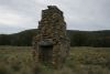
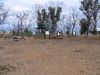
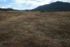
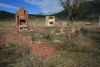
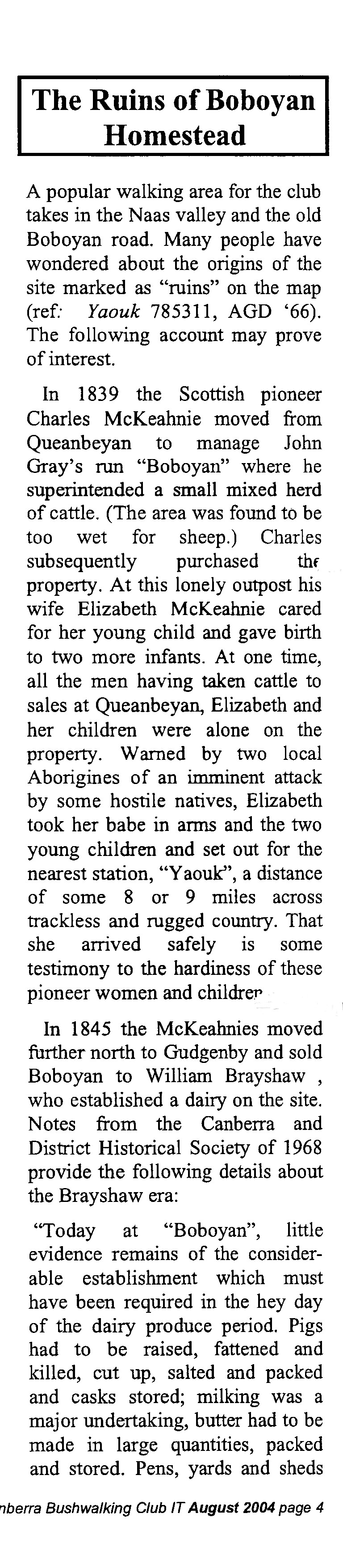
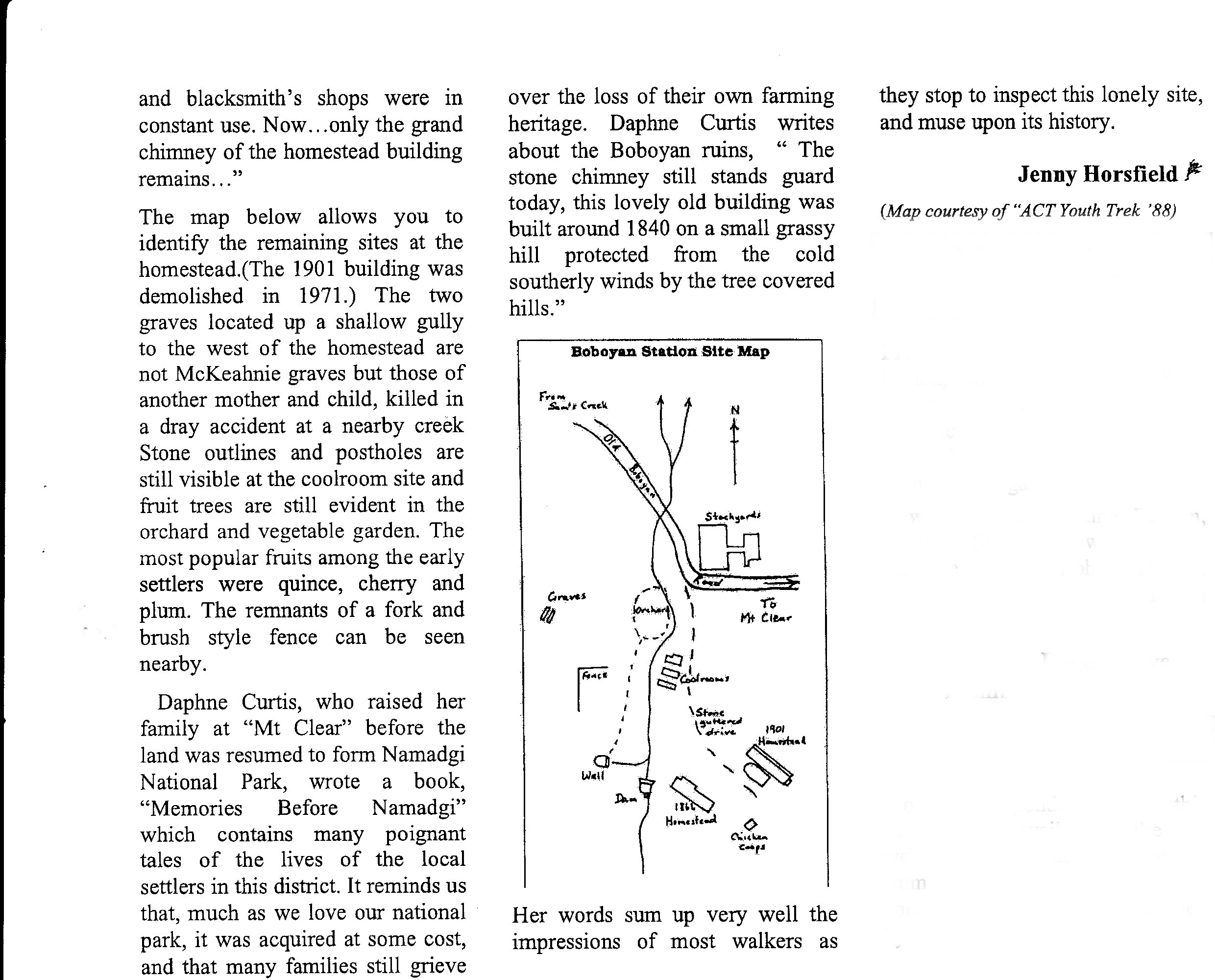
Boboyan Homestead (ruin) |
The original homestead was built in the 1840's and was
replaced in the latter part of last century. It was pulled down in 1971.
The chimney still stands, a sentinel to a bygone pastoral era. (1) See here and
here for further history. (Source: Jenny H Canberra Bushwalking Club it Aug 2004, pp 4-5)
This
was the second building on the site, but was demolished by the
Parks service in 1971, as it was considered to be unsafe.
Today, it would be fully restored. The first building was
owned by James Ritchie and John Gray, when they held the
leases from the late 1830s. John Gray sold the holding to his
manager, Charles McKeahnie in 1844 after Gray went bankrupt.
McKeahnie soon sold his sharee (the other being to Alexander
Crawford) to William Brayshaw soon after Brayshaw's marriage
to Crawford's daughter, Flora. So, the Crawfords and
Braywshaws jointly ran the Bobeyan Valley for many years,
though the Crawfords soon moved up the valley to the Old
Station. The last Brayshaw to live here full time, was
Richard, born in 1865. He sold the property to Noel and Greg
Luton in 1952. This building was built in the late 1800's and
had a separate kitchen and living areas from the bedroom
wings. Unmarked graves are nearby. (Source: KHA). See here for KHA entry.
There are associated sites in the immediate vicinity including
an original cottage site, dam, spring, orchard, stockyard site
and cultivation paddock and (unsighted by me) chicken coops
and 4 sheds.
"Located at grid reference: 678648 East, 6031255 North Richard was the last of the immediate Brayshaw family to live in the homestead. Richard left Bobeyan in 1952. He died on the 11 Jan 1954, eight son thirteenth child. William & Flora raised 14 children in this homestead and the old one. Sarah their 10th child died (from diphtheria) on the 11th Jun 1865 and is buried over the hill just up from the orchard. She was only 8 years old. The original home was built sometime between 1839 and 1844, the new was built sometime before 1866." (Source: Steve Brayshaw's paper)
"OLD ROAD WHERE DRAY TIPPED OVER KILLING MOTHER & CHILD Located between grid reference: 675960 East, 6031132 North & 675205 East, 6031463 North Road has formed banks out of bush rock very interesting to look at. Not known exactly who they are but a mother and child were killed, buried at Bobeyan near where Sarah is buried." (Source: Steve Brayshaw's paper)
"Just doing a little research and have found a Coroners' inquest into the death of a mother and child who died on the 23rd June 1850, the inquiry was at Queanbeyan and related to a Mary & Mary Ann Westerman, clutching at straws here but these 2 could be the Mother and Child buried at Bobeyan along with Sarah.
Without getting the whole inquest from the State Archives of NSW, it still will remain a bit of a mystery.
Oh by the way the coroner found death by accident" (Source: email from Steve Brayshaw 24/5/11).
|
Yaouk |
B2 1-12
B2 2-12
B2 4-12
B2 6-12
B2 8-12
B2 9-12
B2 10-12
B2 11-12 |
|
258,
310,
195 |
31Aug-1Sep 13
27 Sep 11
19 Jul 11*
5 Mar 11
24 Jun 08
18 Mar 08
25 Apr 07*
2 Oct 04
3-4 Jul 04 |


|
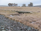
| Bogong Creek Bridge and boardwalk |
Has a plaque "YANKEE HAT TRACK
This bridge and improved access to the Aboriginal
paintings at Yankee Hat was opened by Rosemary Follett
Chief Minister of the ACT 6 May 1992" | Rendezvous Creek |
|
|
|
numerous other times
25 Aug 09
2 May 09*
22 Jul 08
numerous other times |
 |
| Bogong Creek Bridge - site |
Marked on 1st edition Yaouk 1:25000 map, not on 2nd edn |
Yaouk |
|
|
|
22 Jun 10*
25 Aug 09 |
 |
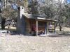
| The Bog Hut |
Located in a very remote part of the Booth Range, Namadgi
National Park. On the Colinton map at GR844415. Its name stems from
the boggy area around, and the general cold and damp of the area
during winter. Access is usually made from the Boboyan road, on a
compass bearing. History
This hut was built by Ted and Tom Oldfield about 1928, after they
had acquired the lease to Block 6 from the De Salis family. George
Gould assisted in its construction, and was later to live there
almost all year round, a very lonely existence. He looked after
fences and kept the dingoes at bay. When mustering time came around,
the Oldfields would join him in the task.
The hut collapsed in the late 1980s, but prior to the 2003 fires,
the roof was intact and reconstruction could have occurred easily.
Its fate following the fires is unknown.
Construction
The hut was built from timber poles with an iron clad gable roof.
Caretakers - none.
References Matthew Higgins "Voices from the Hills" Matthew Higgins "Namadgi Sites" 1994, P4. See
here
for KHA entry. |
Colinton |
|
|
251 |
22 May 07* |
 |
| Border Marker 265 A42 Survey Blaze |
SoS G45 Border Basalt Geological and Historical Site |
Shannons Flat |
|
G45 |
20 |
13 Apr 10
24 Jun 08* |
 |
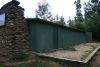
| Brandy Flat Hut |
Tom and Barbara Gregory built a hut on the Brandy Flat site in the 1890s. There
may have been a hut on the site before this. The Gregory's place was
replaced by a slab hut in the 1940s by Kevin Foster which had collapsed
by 1978. This present hut, situated
about one hundred metres from the original site, was built in the 1980s
by the ACT Parks and Conservation Service for the use of walkers.(Signage in Brandy Flat Hut).
See
here for KHA entry |
Michelago |
|
|
876 |
16 Jan 07
19 Aug 06
26 Jul 06* |
 |
| Brayshaws Hut |
This extant hut was named after David (Davey) Brayshaw
(1852-1931), the sixth of fourteen children to William and Flora
Brayshaw. It was built in 1903 possibly by an elder brother, Edward. It
was a slab dwelling with a shingle gable roof, which was later clad with
iron. A slab skillion was also part of the structure.
See here.
See
here for KHA entry. |
Shannons Flat |
B22 1-3 |
G40 |
264 |
23 Mar 13
15 Mar 11
28 Dec 10
20 Jul 10
24 Jun 08
18 Mar 08
8 May 07* |
 |
|
Bridle track to Rendezvous Creek |
Commences at a gate on the treeline about
the 1000m contour. Terrace on hillside; wooden gate of machine-sawn
timber and wire rails. This is the
at the start of the Nursery Swamp Walking Track and continues along the
taped footpad to Rendezvous Creek. |
Rendezvous Creek |
OR22 |
|
|
numerous other times
29 Apr 08*
12 Feb 08
16 Jan 08
10 Apr 07
23 Sep 06
28 Jun 06
23 Sep 05
2 Apr 05
11 Jan 03 |
 |
|
Brumby Yard Site 11 |
See
Aussie Heritage description |
Corin Dam
756645(ADG66) |
|
|
271 |
6 Jan 09* |
 |
| Bulls Head fire tower site |
Built 1948. Identified to me by Matthew Higgins. See Rugged Beyond Imagination p129. |
Tidbinbilla |
- |
- |
- |
18 Jun 11* |
 |
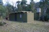
| Bushfold Flats shed (destroyed by fire) (aka Bushfold Hut)/Russ and Muriel Read's 1957 Hut site |
Built in 1957
by the Read family to replace an earlier structure ruined by gales. Used
for shelter while the owners worked their stock. It's surprisingly tall
and built of corrugated iron with dressed timber providing one wall.
Bush posts and rafters support the roof, the floor is dirt, and a couple
of ancient refrigerators stand near the door. (Namadgi & Tidbinbilla Classics: Tough Bushwalks in
Canberra's High Country Graeme Barrow, Dagraja Press Canberra, 2000, pp
41-42).
See
here for KHA entry. See NPA Bulletin article here by Matthew Higgins |
Williamsdale |
TH3 |
|
859 |
numerous other times
12 Jul 11
16 Dec 08
21 Oct 05
25 Mar 05* |
 |
| Bushfold Hut (rebuilt)/Gearge and Russ Read's hut |
Rebuilt on site of Bushfold Shearers Quarters.
See
here for KHA entry.
Signage in the hut says:
Bushfold Hut. The original hut
that stood on this site was built in 1954 by George Reed and his son
Russell. They built the section which is now the Southern end of the
hut. In the mid 1960s, this parcel of land was acquired by Dr Hugh
Pearson. He added the northern end which comprises two vehicle bays.
Depending on who you ask, the hut is known as Bushfold, Reed's or
Pearson's.
Bushfold Flat was added to Namadgi National Park in 1991 along with Mt
Tennent. It is a natural grassland that has been extended by past
grazing and clearing. Bushfold hut has [sic] was badly damaged by the
2003 bushfires (see below) and was subsequently demolished by parks
staff and NPA volunteers. The hut you are now standing in was built on
the original site by the Kosciusko Huts Association in 2004. Many
original materials were used during rebuilding.
Originally the hut had a frame of locally milled bush timber clad in
corrugated iron with a skillion roof. The northern part of the building
was an open shed that could house machinery or vehicles. The southern
end was a fully enclosed shelter for accommodation. A fireplace was
located at the southern end with the main firebox made from part of an
old ship's tank and a chimney made of 20l drums welded together. The
floor was a mixture of bare earth and a concrete slab which is still
intact and defines the building footprint. Structural stability was
achieved using vertical framing posts set into the ground. South of the
hut are the ruins of old sheep yards and to the northeast is the
remnants of an old sheep pen or hayshed. See NPA Bulletin article here by Matthew Higgins. The W-G description of this site as a shearing shed is incorrect |
Williamsdale |
TH5 1-2 |
|
- |
9 Feb 13
12 Jul 11
8 Sep 09
16 Dec 08
8 Jul 08* |
 |
| Bushfold Shearing shed/Read's 1-stand shed |
Immediately E of the junction of the Bushfold Flats ft and ft that goes to Blythburn Cottage. See NPA Bulletin article here by Matthew Higgins |
Williamsdale |
TH4 |
|
- |
14 Sep 13
24 Mar 12
12 Jul 11
8 Sep 09
16 Dec 08
9 Sep 08* |
 |
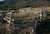
| Bushfold Sheep yard |
Adjacent to Bushfold Hut (rebuilt) with Bushfold Flats track running through them |
Williamsdale |
TH5 2-2 |
|
173 |
16 Dec 08* |
%20and%20Sheep%20yard%20(W-G%20TH5%202-2)%20site_t.jpg) |
|
Bushfold Sheep yard |
Near Bushfold Hut (rebuilt).
Shearers' quarters of site TH5 1-2 are 65m at 332°.
Bushfold track is 20m due east on the timberline. Site stands in well
grown timber. Now just a clearing |
Williamsdale |
TH7 |
|
- |
8 Sep 09* |
 |
| 'Bushford' (site) - Bushfold Covered Sheep Pen |
Marked on 1st edn map |
Williamsdale |
TH6 |
|
289 |
16 Dec 08
8 Jul 08* |
 |
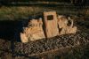
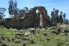
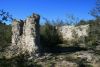
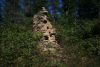
| Chalkers Chimney |
Located to the south of Mt Clear at GR840263 on
the Bredbo map. A large chimney is all that remains. History
This holding was originally surveyed in 1889 as a
conditional purchase by Edward Brayshaw, the fourth son of
William and Flora Brayshaw.
Edwards wife Mary, was from the Chalker family, but the
site was forfeit in 1892. Henry Barrett acquired the site in
1908, but the history between is unclear. The Chalkers may
have owned the site after this.
Construction
The chimney is made
from heavy granite
blocks. See
here for KHA entry.
Chimney of granodiorite, mud-mortared, with cement overlay
on external joints; stone edged soil platform (stone
flagging may be concealed). Portion selected as a
Conditional Purchase (without prior improvement) by Edward
Brayshaw in 1889. (W-G T) |
Bredbo |
BR16 1-3 |
G47 |
158 |
24 Sep 13
30 Jul 13
25 Jul 09
8 May 07* |
 |
|
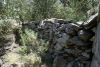
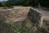
Hut site immediately adjacent Chalkers Chimney |
Vestigial, notable for extensive use of
stone in wall and in flagged floor (W-G T) |
Bredbo |
BR16 2-3 |
|
158 |
24 Sep 13
25 Jul 09* |
 |
|
Stockyard near Chalkers Chimney |
Vestigial. Post and four rail, rough timber;
granodiorite floored cowbail (W-G T) |
Bredbo |
BR16 3-3 |
|
- |
25 Jul 09* |
 |
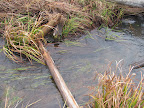
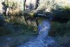
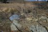
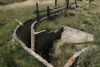
| Concrete ford under Orroral River |
|
Corin Dam |
|
|
- |
23 Jun 09* |
 |
| Cotter Hut |
The Cotter Hut, in the Cotter Flats, was built in the
1890s by Thomas Oldfield. See
here for entry in ACT Heritage Register. See
here for KHA entry. |
Rendezvous Creek |
|
|
233 |
numerous other times
13 Nov 10
1-4 Oct 10
7-8 Jun 08
12-14 Sep 06
3 Oct 05* |
 |
| Baby Crawford plaque |
A small brass plaque glued to the face of a block of granite reading: 'In Memory of Baby Crawford Infant Son of Dalla and Dan Died 13-6-1915'
|
Yaouk |
- |
- |
- |
3 Sep 11
19 Jul 11*
18 Mar 08 |
 |
| Crawford Homestead (Old Station) |
Site may have dated originally from the 1840s. In a survey in 1883 the house was valued at 50 pounds. The building fell down in the 1950s and the site was bulldozed to destroy harbour for rabbits. Today some of the fireplace remains standing and other... (from KHA database) |
Yaouk |
B10 |
|
288 |
31Aug-1Sep 13
3 Sep 11
19 Jul 11
26 Apr 11* |
 |
| Crawford Homestead orchard plantings |
|
Yaouk |
|
|
311 |
31Aug-1Sep 13
3 Sep 11
19 Jul 11* |
 |
| Norman and Esma Curtis’ house site |
Mentioned in the new (Jun10) Settlers Track brochure. Where/What is it? Could be W-G B24? |
|
|
|
? |
|
|
|
David Brayshaw's Cairn |
In August 1931 David met a tragic
end while riding home from nearby 'Bobeyan' where his brother
lived. He left after lunch but didn't arrive home that
evening. Two days later his riderless horse was found with
David's body lying nearby. Stirrup irons were still on his
feet and his hat and whip were on the ground nearby. He had
died from exposure. Today the place is marked by a small pile
of white rocks. David was 79 years of age.
(Signage at Brayshaw's Hut)
"DAVID BRAYSHAW'S CAIRN Located at grid reference: 679452 East, 6030943 North Jim Westerman placed the rocks where they are, under instructions from Morris Luton. Mary Jane Westerman, his sister in law collected the rocks. Davey left his brother Richard in the afternoon after having lunch with him, as he always did once a week. Just down from Bobeyan he was thrown from his horse and died from exposure. He died on 31 August 1931, Fourth son sixth child." (Source: Steve Brayshaw's paper) |
Yaouk |
B1 |
|
- |
31Aug-1Sep 13
19 Jul 11
24 Jun 08
18 Mar 08* |
 |
| Demandering Hut |
Was part of Demandering Run that was leased by James
Booth and later Gareth Cotter. The hut was built by Bill Cotter in the
mid 1940s. See
here for entry in ACT Heritage Register. See
here for ACT Government brochure. |
Colinton |
|
G27 |
254 |
5 Oct 13
14 Feb 13
5 Feb 13
13 Mar 07* |
 |
| Drop-log fencing on the SW border |
A total of
1.6km in 0.74km and 0.86km segments. There may be more. Marked on
original border survey diary
A 1089 - G40 to R87 - FC18 sheet 9, 10 - (PDF 14.0 mb)
as Fork and Pack Fence |
Shannons Flat |
|
|
- |
23 Mar 13
28 Dec10
13 Apr 10* |
 |
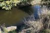
| Dry stone walls above Glendale Crossing |
Linking natural boulders - to form an animal holding area?
Does anyone know their history? |
Michelago |
|
|
- |
14 Nov 10
20 Nov 07* |
 |
| Duncan McKeahnie's 1884 hut site |
See NPA Bulletin article here by Matthew Higgins |
Williamsdale |
- |
- |
- |
24 Mar 12
12 Jul 11* |
 |
| Dunns hut c1910 site |
See NPA Bulletin article here by Matthew Higgins |
Williamsdale |
- |
- |
865 |
14 Sep 13
12 Jul 11* |
 |
| Dwyer's Hut site |
Mentioned in the new (Jun10) Settlers Track brochure. Where/What is it? |
|
|
|
? |
|
|
| Edward Brayshaw's Hut site |
The remains of this hut consist of remnant chimney stones and a fallen, squared post; suckering fruit trees stand nearby. The hut was not shown in the 1908 survey of the block... (Source: KHA NNP database)
EDWARD BRAYSHAW 1 Located at grid reference: 676321 East, 6033918 North Surveyed on 8th April 1885. Still evidence of an orchard. (Source: Steve Brayshaw's paper) |
Yaouk |
B11 |
|
883 |
19 Jul 11* |
 |
| New Fishloch Yards |
Contiguous with boundary of portions 11 and 18 |
Corin Dam |
OR15 |
|
731,732 |
8 May 12
14 Dec 11
23 Jun 09*
7 Apr 07
7 Nov 06
5 Jun 05 |
 |
| Flying Fox over Gudgenby River (site) |
Adjacent to ford; pylons are 40m from the
water. Two pairs of steel girders (set in concrete) with a timber
platform; steel hawser and free running pulley. |
Williamsdale |
NA1 2-2 |
|
- |
22 Sep 08* |
 |
| Flying Fox over Orroral River (site) |
Crosses Orroral River 100m north of road.
Two bipedal steel pylons footed in concrete; steel hawser; timber and
steel trolley. Orroral Camping Ground. A pylon
base and hawser anchors remain. What was it used for? |
Rendezvous Creek |
OR24 |
|
- |
14 May 11
27 May 08* |
_t.jpg) |
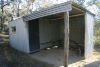
| Foresters Hut |
Near Yankee Hat car park.
This hut was built in 1966 for use by Forestry workers,
engaged in the pine planting near Yankee Hat. The pine
plantation was not particularly successful and the pines are
progressively being removed from the National Park. See
here
and
here for KHA entry.
ACT FORESTS HUTS The small Forestry Hut
was built in 1966 for the planting of the Boboyan Pine Forest and was
used by the forestry gang at lunch and other times for shelter. The
larger building was constructed at the same time as a machinery shed to
house the bulldozer. These huts are conserved for their heritage values
and may be used as a temporary shelter. W ask that visitors abide by the
Huts Code, respect other Park users and take care of this special
environment. (Signage in the Hut) |
Yaouk |
GR4 |
|
247 |
21 Apr 12
13 Jul 10
16 Jun 09
21-22 Jul 07*
21 Jun 06 |
 |
| Frank and Jacks Hut (original) |
UTM 55H 677412-6040583 (GDA 94). The hut was built shortly after 1948, and blew down in the early 1950s. Little sign of the site was evident even before the planting of the Boboyan Pines. The site was searched for and investigated again in December 2001. There was no evidence of the... |
Yaouk |
- |
- |
867 |
14 Sep 10* |
 |
| Frank and Jacks Hut |
Built for grazing in the 1950s. Very suburban looking. See
here for entry in ACT Heritage Register. See
here for KHA entry. |
Yaouk |
GR3 1-3 |
G20 |
248 |
20 Nov 12
27 Mar 12
3 Sep 11
12 Nov 05*
16 Oct 04 |
 |
| Hut site near Frank and Jack's Hut |
Oblong area cut into slope; granodiorite hearth. Valued at £40 in 1891
when surveyed for WF Sinclair. Vestigial, notable for having a square
hearth. |
Yaouk |
GR3 2-3 |
|
- |
3 Sep 11
22 Jul 08
1 Jul 08* |
 |
| Frank and Jacks Yards and Dip |
Twelve fenceposts (including two 'post and
four rail' type). Only the concrete dip and posts remain. |
Yaouk |
GR3 3-3 |
|
716 |
27 Mar 12
3 Sep 11
8 May 10
1 Jul 08* |
 |
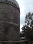
| Geodetic Observatory |
|
Rendezvous Creek |
|
|
|
many times since
14 Dec 11*
many times previously |
 |
| Gipps' House complex |
Weatherboard and fibro with corrugated metal
roof and two external brick chimneys. Shed and garage both corrugated
metal on sawn timber frame. Garage has two timber clad annexes. Chicken
run is sawn timber, wire mesh and 14 slabs. Believed constructed circa
1956 by a road contractor. |
Michelago |
YA14 1-2 |
|
? |
22 Sep 08* |
 |
| Glendale amenities block |
Concrete brick walls and floor; water tower is concrete brick surmounted by concrete tank. |
Rendezvous Creek |
YA11 |
|
238 |
5 Apr 08*
1 Apr 08 |
 |
| Gudgenby Homestead |
Brick veneer, tile roof, one external brick
chimney and one internal chimney. Coolroom is corrugated metal on sawn
timber frame with concrete floor. Constructed in 1964 on the site of
original McKeahnie home. Timber from old homestead (valued at £200 in
1885) now in Cooma museum and chimney stones are in garden wall. The
only two story house in the park. See
here for KHA entry. |
Rendezvous Creek |
G1 1-3 |
G19 |
244 |
20 Mar 12
22 Jul 08* |
 |
| Gudgenby Homestead - two sheds |
Shed 1: corrugated metal and four tanks. Shed 2: aluminium sheet |
Rendezvous Creek |
G1 2-3 |
|
- |
22 Jul 08* |
|
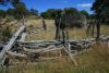
| Gudgenby Stockyards |
Machine sawn timber rails bolted to steel "I" beam uprights sunk in concrete. Constructed in 1968. |
Rendezvous Creek |
G1 3-3 |
|
168 |
22 Jul 08* |
 |
| Gudgenby Homestead - foot bridge to Ready Cut Cottage |
Round timber uprights and beams faced with
machine sawn planks for walking surface and a wire hand rail.
Constructed in 1956 by hand.
Badly washed away Summer 2012 - only the ends remain. |
Rendezvous Creek |
G2 3-4 |
|
169 |
20 Mar 12*
22 Jul 08* |

 |
| Gudgenby cultivation patch |
Adjacent modern ford across creek to Manager's ouse via bull paddock. On north side of creek. Cultivated
1927-1938 by Frank Oldfield. |
Rendezvous Creek |
G2 4-4 |
|
- |
22 Jul 08* |
 |
| Hines' Hut site |
From MH material via KS |
Colinton |
|
|
872 |
29 Jan 09* |
 |
| Honeysuckle Creek (lower) Hayshed (site) |
15m south-west of old Honeysuckle track. Corrugated metal on girder frame, steel gates, aluminium roof. |
Williamsdale |
NA6 |
|
- |
8 Jul 08* |
 |
| Honeysuckle Hut and Stockyard (site) |
Hut is (was) corrugated metal on rough wood frame with one external chimney. Yards are (were) wire netting on timber
posts and star pickets. |
Corin Dam |
NA7 |
|
278 |
8 Jul 08* |
 |
| Horse Gully Hut |
The new Horse Gully Hut was built by Tom Roseby and Stan Bowerman in the
1940s. Great difficulty was experienced in obtaining sufficient sand for
the concrete required for the footings and chimney.(1)
This hut was built by Tom Roseby in the 1940s and was
part of the Bumbalong Run. Tom's father, Sydney, purchased Bumbalong in
1918. The original hut, 20m to the east of he existing hut had a stone
chimney and was valued at 6 pounds in 1897. Quince trees nearby were
probably planted by the early settlers. Subsequent owners, Colin and
Norman Curtis stayed at the hut when mustering cattle, fencing and
rabbiting.See
here ).
See
here for entry in ACT Heritage Register. See
here for KHA entry. See
here for entry in ACT Heritage Register.
See
here for ACT Government brochure. |
Colinton |
BU1 1-3 |
G26 |
253 |
5 Oct 13
14 Feb 13
29 Jan 09
13 Mar 07* |
 |
| Stockyard (near Horse Gully Hut) |
Immediately adjacent west side of Naas-Mt
Clear track at entrance to grassy flat; 200m north of hut sites. |
Colinton |
|
|
720 |
29 Jan 09* |
 |
| Hospital Creek Hut |
Hospital Creek Hut was built in about 1966 by brothers Frank
and Jack Oldfield along
with Jack's son Les. The Oldfield family has played an important role in
the development of the Namadgi region. The hut was on the Oldfield's Dry
Creek lease an was used for overnight shelter whenever the Oldfields
were working on the lease. In 1979 the lease was resumed as part of the
Gudgenby Nature Reserve and incorporated into Namadgi National Park when
it was declared in 1984.(Signage in Hospital Creek Hut).
See
here for entry in ACT Heritage Register. See
here for KHA entry. |
Yaouk |
GR1 |
G21 |
249 |
20 Nov 12
27 Mar 12
3 Sep 11
9 Mar 10
16 Jun 09
1 Jul 08
21 Jun 06* |
 |
|
'Hut' at confluence of Stockyard
Creek and Cotter River |
'Hut'
marked on 1st edn Tidbinbilla map at confluence of Stockyard
Creek and Cotter River. Bummer - a modern gauging station
shed! Mike S said much of the building material came in by boat up the
Bendora Dam. |
Tidbinbilla |
|
|
- |
6 Nov 07* |
 |
|
James Brayshaws Hut (site) |
Grove of quince trees in a vale 300m south
of road. Valued at £20 (with garden) for James Brayshaw in 1882. The
extent of the cultivation paddock cannot be determined as it has become
a marsh.
"James Brayshaw was the twelfth of the children born to William and Flora Brayshaw. The hut was valued at 20 pounds when the block was surveyed in 1882. The foundation stones remain today, lying under overgrown quince trees." (KHA datbase)
"JAMES BRAYSHAW'S HUT Located at grid reference: 679389 East, 6030138 North James left the area in 1906 to a place in Victoria called Koo Wee Rup. He came back to Bobeyan just before he died. He and his brother Richard, at the time the only 2 surviving children of William & Flora. They got together and apparently were like two school kids (they had not seen each other for about 20 years) anyway no sooner they had got together they had had enough of each other and parted. James went back to Victoria the next day. (From Auburn Brayshaw, Morris Luton) He died on 23 October 1951, Seventh son twelfth child." (Source: Steve Brayshaw's paper) |
Yaouk |
BR11 |
|
317 |
24 Jun 08* |
 |
|
John Brayshaw's two hut sites |
About 100m north-west of ford across Naas Creek. Hut
valued at
£45 in 1879, erected by John Brayshaw. Site has been bulldozed. Hut
2 is indented into a steep bank and has a square mound in its centre.
Condition of site is vestigial (W-G T)
Hut sites (2) also known as Barrett’s (Steve B) |
Colinton |
BR8 |
|
313 |
24 Sep 13
5 Feb 13
25 Jul 09
29 Jan 09* |
 |
 |
|
Joseph Greenfield's/T Brayshaw Hut site |
120m south of Rendezvous Creek on a northern slope.
Originally valued at
£15 for Joseph Greenfield. |
Rendezvous Creek |
G4 |
|
320 |
8 Sep 10* |
 |
| Lone Pine Homestead (ruin) |
Dan Crawford
built the homestead about 1890 and lived there with his wife and six
children. He is said to have run a dairy and made cheese in summer which
he took to Sydney in winter by dray, leaving his family at the
homestead. Another source says it was probably built in 1907, with the
pine tree having probably been planted at the same time.
(Exploring Namadgi & Tidbinbilla: Day Walks in Canberra's
High Country Graeme Barrow, Dagraja Press Canberra, 1987, p 48) |
Yaouk
|
B13 1-3 |
G34 |
257 |
3 Sep 11
19 Jul 11
18 Mar 08*
3-4 Jul 04 |
 |
| Lone Pine Homestead mixed exotics |
|
|
|
|
312 |
3 Sep 11
19 Jul 11* |
 |
| Lutons Crutching
Shed |
"This
Crutching Shed was built by Noel Luton, Alan Robinson and Herb Dybal in the mid 1960s. The
fork-style log fence was built by the Crawfords in the 1800s. Alterations
for re-use have occurred to both structures over time. The Crutching Shed is
the only structure of its type in Namadgi National Park and may be the only
purpose built crutching shed in the Alps National Parks. The fork-style
stockyards are significant for representing a type of vernacular fencing no
longer used." (Signage at Lutons Crutching Shed)
"Shed and adjacent yards built by Noel Luton and others in the mid to late 1960s. The shed was extended in the early 1970s. It is the only purpose built crutching shed in either Namadgi or Kosciusko N.P. and is one of only three surviving pastural buildi..." (KHA database)
"Valued at £21 when surveyed for Edward Crawford in 1883... The complex has been extensively reconstructed; the shearing shed is recent (still shiny!) and is currently maintained." (W-G B9)
See
here for KHA entry.
|
Yaouk
|
B9 |
|
280 |
31Aug-1Sep 13
8-9 Sep 12
3 Sep 11
19 Jul 11
26 Apr 11
12-13 Jul 10
28 Nov 06*
16 Oct 04
3-4 Jul 04 |
 |
| Martin McMahons post 1902 Hut site/Bushfold Hut remains |
Near TH3. See NPA Bulletin article here by Matthew Higgins |
Williamsdale |
TH2 |
|
859 |
12 Jul 11
16 Dec 08* |
%20site_t.jpg) |
|
Michael Herbert memorial |
This cairn marks the resting place
of Michael Herbert the first known settler in the district of
Naas, who died about a hundred years ago. These stones came
from one of his buildings March 1957
(Plaque on the cairn)
English migrant William Herbert was at Naas
valley by the early 1830s.
(Source: Rugged Beyond Imagination
Matthew Higgins P 24) |
Williamsdale |
NA2 |
|
- |
18 Mar 08* |
 |
|
Middle Creek bridge |
Marked on 1st edn map. Replaced by concrete ford. |
Rendezvous Creek |
|
|
- |
1 Dec 12
22 Jul 08*
22 Jul 08* |
_t.jpg) |
|
Middle Creek yards site |
Marked on 1st edn map |
Rendezvous Creek |
|
|
- |
2 May 09* |
 |
|
Mrs Matheson's grave |
MH material via KS |
Colinton |
|
|
274 |
29 Jan 09* |
 |
|
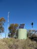
Mt Clear water tank |
Wholly covered in cement. Height 2.1m, Circumference
5.5m. (W-G T) |
Colinton |
BR4 |
|
- |
29 Jan 09* |
 |
|
Mt Clear Homestead complex |
Nothing can be identified except some
concreted flagstones in the grass near the functional loo |
Colinton |
BR5 |
|
284 |
25
Jul 09* |
 |
| Mt Franklin Road 7½ Mile survey blaze |
A blaze indicating 7½ miles from Piccadilly Circus |
Tidbinbilla |
|
|
- |
30 Apr 11
12 Apr 11
2 May 10* |
 |
| Mt Franklin ski chalet (destroyed by fire) |
The Mount Franklin Chalet, built by the Canberra Alpine Club early in 1938,
was the oldest club-built ski lodge in the Australian Alps National
Parks. It was destroyed on 18 January 2003 by bushfire.(Signage at Mt Franklin ski chalet site)
This hut was specifically built
for skiing and was the oldest club-built ski lodge on mainland
Australia (older lodges exist in Tasmania). It was built in
the summer of 1937-38 for the Canberra Alpine Club. A large
kitchen and living area is downstairs and bunk rooms upstairs.
A toilet was built in nearby NWS, to satisfy the Cotter
catchment regulations, so the hut is very close to the border.
The hut was upgraded in the 1950s, with internal lining of
baltic pine. The present kitchen stove came from the Prime
Minister's Lodge. The doors to the stove were stolen within
days of the lodge being burnt down. Ski runs were also cleared
nearby, but have now largely overgrown. See
here for KHA entry. |
Tidbinbilla |
|
UC2 |
197 |
15 Oct 08
6 Nov 07
17 Apr 07
15 Mar 06* |
 |
|
Naas Creek bridges (ruins) |
Two bridges. Bridge 1 marked on
the 1st edition Yaouk map at GR785317(ADG66) |
Yaouk |
B3 |
G31 |
- |
27 Sep 11
19 Jul 11
24 Jun 08
18 Mar 08* |
 |
| Naas Creek fork fencing |
A substantial line of old fork fencing on the right bank of the Naas Creek, stretching along below Lutons Crutching Shed |
Yaouk |
|
|
|
19 Jul 11* |
 |
|
Naas Creek valley bridges |
Two modern wooden bridges in the Naas Creek valley. Bridge 1 over Sheep Station Creek near its confluence with the Naas Creek and the other over a feeder creek near the top of the valley |
Yaouk |
|
|
- |
19 Jul 11
12-13 Jul 10* |
 |
|
Naas ford |
Site of the ford of the Gudgenby River just downstream
from the bridge at Naas carrying the Boboyan Road
|
Williamsdale |
NA1 1-2 |
|
- |
18 Mar 08* |
 |
|
Oldfields Homestead Site |
On a terrace above Cotter Flats
near a poplar tree. A small orchard still exists.
Built in 1893 by Thomas (and Hannah) Oldfield.
(Source: Rugged Beyond Imagination
Matthew Higgins P 28) |
Rendezvous Creek |
|
UC16 |
294,182 |
4 Feb 12
13 Nov 10
1-4 Oct 10
9-10 Jan 09
7-8 Jun 08* |
 |
|
Orroral Cattleyards |
Quarry, Cattleyards,
Flagstone floor west of yards, Paddock NW of yards, Former
post holes east of yards, Ploughed paddock east and north of
yards |
Rendezvous Creek |
OR7 1-2
OR7 2-2 |
G5 |
166 |
14 May 11
3 Jan 11
27 May 08*
9 Jun 03 |
 |
|
Orroral Homestead (Old) |
This is one of the earliest sites
of European settlement in the region. Established in the 1830s
by William Herbert it was an illegal settlement because it was
outside the 'Limits of Location'. In 1838 there were 10
residents, a slab hut, 9 acres under cultivation, 37 horses
and 700 cattle on the 12,800 acre property. The Orroral Run
changed hands many times. Charles McKeahnie purchased the run
in 1864. In the late 1860s he and his son Archibald
constructed a newer homestead further up the valley. The ruins
of the main building, two or more smaller ones, a cultivation
paddock, a line of stones (presumable a fence line) and the
original track route into the valley are all that remain of
this pioneer settlement.
(signage at site)
See
here for entry in ACT Heritage Register. |
Rendezvous Creek |
OR3 |
|
234 |
27 May 08*
29 Apr 08 |
_t.jpg) |
|
Orroral Homestead |
Orroral is a magnificent
homestead, typical of the period and easily accessible. It has
been well restored, and features a central slab homestead,
plus outbuildings. The homestead was built for Archibald and
Mary McKeahnie for grazing in the 1860's. It has three rooms
and a chimney at each end, plus a full length verandah at the
front. The original kitchen and staff quarters were built
behind, and were as large as the house. The main chimney for
the kitchen remains. The stockyard and woolshed were built for
a later owner, Andy Cunningham in the 1930s.
See
here for KHA entry. See
here for entry in ACT Heritage Register.
See NPA Bulletin Volume 20 number 4 June
1983 page 12-14
here for history. |
Rendezvous Creek
|
OR6 7-10
OR6 8-10
OR6 9-10 |
G5 |
227 |
numerous other times
14 May 11
3 Jan 11
27 May 08
10 Apr 07
9 Jun 03* |
_t.jpg)
 |
|
Orroral Homestead (New) |
Gregory's House. 1950s House -
After the Second World War, the Orroral Run was purchased by
the Gregorys. They built this weatherboard house to
accommodate people working on the property. After the
construction of this house the original homestead ceased to be
used for accommodation. The house was removed in 1991 after
being badly damaged by vandals.
(signage at site)
See
here for entry in ACT Heritage Register.
Gregory's Homestead ruin, Gregory's orchard, Gregory's garden,
Gregory's dam, Two fenced pine trees west of Gregorys, One
fenced pine tree west of Gregorys, Former toilet, Collapsed
pen and metal tank. |
Rendezvous Creek |
OR6 1-10
OR6 4-10 |
G5 |
871 |
14 May 11
3 Jan 11
27 May 08*
9 Jun 03 |
|
|
Orroral Hut site (upper valley) |
Hut foundation. Junction of Booroomba
Creek/Orroral River is 150m north. Six postholes (not seen), collapsed
granodiorite chimney. Site is on NNE slope with Sawpit Creek gap to the
south (?). Condition is vestigial. |
Corin Dam |
OR17 |
|
884 |
23
Jun 09* |
 |
|
Orroral Hut site (mid valley) - Patrick
McLaughlin |
Hut foundation. 10m south of track, 120m
west (? more NNW) of site OR11 (Rowleys Orroral Hut). Entrenched
outline, raised flooe space, collapsed granodiorite chimney. Valued at
£15 in original 1884 survey and attributed to Patrick McLaughlin. Site
is vestigial. |
Corin Dam |
OR14 |
|
875 |
14 Dec 11
23 Jun 09* |
 |
|
Orroral loading pen and cattle ramp |
Adjacent junction of Orroral Valley road and
Sawpit Creek firetrail. Weldmesh on concrete foundations; timber ramp |
Rendezvous Creek |
OR9 |
|
- |
27 May 08* |
_t.jpg) |
|
Orroral Picnic Ground - Amenities block |
Immediately adjacent old Naas/Boboyan road.
Pebble and concrete floor, concrete brick walls, aluminium roof, timber
screening walls. |
Rendezvous Creek |
NA28 2-3 |
|
230 |
29
Apr 08* |
 |
|
Orroral Picnic Ground - Concrete weir and river
flow meter |
Metal tower; concrete weir |
Rendezvous Creek |
NA28 3-3 |
|
231 |
29
Apr 08* |
 |
|
Orroral Picnic Ground - Water tank |
Two concrete tanks on a concrete brick stand
with surrounding wall. |
Rendezvous Creek |
NA28 1-3 |
|
- |
29
Apr 08* |
 |
|
Orroral River Footbridge site |
A footbridge originally made of
re-used plywood on old battens; two tree trunks; the whole
nailed and wired together then wired to neighbouring rocks.
Presumably built to enable sheep to graze both banks of
Orroral River. |
Corin Dam |
OR12 |
|
- |
14 Dec 11
1 Aug 09
27 May 08* |
 |
| Orroral Tracking Station sewerage ponds |
|
Rendezvous Creek |
|
|
211 |
3 Jan 11
27 May 08* |
 |
|
Orroral Valley stockyard site |
Contiguous south-west boundary of portion on
south side of track connecting site OR11 with Sawpit Creek firetrail.
Windfallen timber, droplog, paling and wire mesh; eleven live trees
incorporated in framework. |
Corin Dam |
OR13 |
|
- |
8 May 12
14 Dec 11
15 Sep 09* |
 |
|
Orroral Valley stockyard site |
Site is adjacent to the gate on the old
Orroral track and is contiguous with the eastern boundary of Portion 32. |
Rendezvous Creek |
OR2 |
|
- |
27 May 08* |
_t.jpg) |
|
Orroral Valley stockyard site |
Adjacent north side of track 1.2km from gate
at Portion 32. Site OR3 is 150m away. |
Rendezvous Creek |
OR4 |
|
- |
27 May 08* |
_t.jpg) |
|
Orroral Woolshed |
Woolshed, Woolshed yards, site of
former yard NNE of woolshed, 'Horse works' gearing disc,
collapsed yards and former shed site.
See
here for entry in ACT Heritage Register. |
Rendezvous Creek |
OR6 6-10 |
G5 |
226,167 |
27 May 08* |
 |
|
Paddy Moore's Hut site |
Rendezvous Creek is 180m north at bottom of a steep
slope. Portion surveyed for Patrick Moore in 1908. Hut was demolished
circa 1927.
Paddy Moore was a selector.
(Source: Rugged Beyond Imagination
Matthew Higgins P 28) |
Rendezvous Creek |
G5 |
|
302 |
8 Sep 10
22 Jul 08* |
 |
|
Paddy Smith's hut and shed site |
100m south-west of Hospital Creek. Vestigial.
Paddy Smith was a selector.
(Source: Rugged Beyond Imagination
Matthew Higgins P 28) |
Yaouk |
GR5 |
|
291 |
22 Sep 08* |
 |
|
Potters Chimney |
Charles Potters. A stone
hearth/chimney complex made from dark slate fixed with mud
mortar. An unusual feature is a square recess set into the
chimney wall, probably as a dough rising or warming box. See
here for KHA entry. |
Bredbo |
BR13 |
G42 |
266 |
30 Jul 13
25 Jul 09
13 Mar 07
8 May 05* |
 |
|
Pryors Hut |
Pryors Hut was built at the northern
base of Mt Gingera in 1952. It is named after Professor Lindsay Pryor.
The hut was used as a shelter for Pryor and other men working on the
Alpine Botanic Gardens, on the side of Mt Gingera. The huts design
also allowed for a small ante-room as an emergency shelter for the
public. (See here).
See
here for KHA entry. See
here for ACT Heritage Register.
The hut was built as Alpine
Botanic Hut in the early 1950's. As the sign on the door
indicates, it was built for personnel tending the alpine
annexe of the National Botanic Gardens. This was established
in the Mt Gingera area under the supervision of Lindsay Pryor,
the Superintendent of Parks and Gardens. A coastal annexe was
established at Jervis Bay.
In the late 1950's, Pryor was appointed Professor of Botany at
Canberra University College (later ANU). Emphasis was then
placed on the development of the present Gardens site at Black
Mountain and the coastal annexe. The alpine annexe fell into
disuse. The only traces of it now are this hut, remains of the
old horse paddock nearby and some plant markers made of huon pine on a
metal stand.
The pines below the hut were planted in the 1950s by members of the
Snowy Mountains Authority Landscape Section. They are Scotts Pine (Pinus
silvestris).
The hut became known as Pryors Hut in recognition of Professor Pryor's
contribution to the development of the Botanic Gardens, the study of and
horticultural development of native plant species, the landscape
development of Canberra and the evolution of the Australian forestry
school and industry. (Signage at hut) |
Corin Dam |
|
|
215 |
numerous other times
30 Apr 11
12 Jun 10
11 May 10
5 Sep 09
19 May 09
14 Apr 09
21 Mar 09
17 Mar 09
9-10 Jan 09
3 Jun 08
6 Feb 07
4
Jul 06*
25 May 05 |
 |
|
Ready-Cut Cottage |
See
here for KHA entry.
The Hudson's Ready-Cut
Cottage - Gudgenby
This cottage is an early
ready-cut or prefabricated
kit home produced by
George Hudson Ltd, Sydney.
It was purchased and
probably erected by A W
Bootes, the Gudgenby
Valley property owner in
1927.
The Bootes family travelled
from the family home at "Bywong"
each summer for the busy
branding and weaning
period and used the
Cottage for accommodation.
The main double-brick
Gudgenby Homestead on the
other side of the Gudgenby
River was completed in
1964 and from this time
the cottage became known
as the Manager's Cottage.
Alterations were made to
the back of the building
to include a laundry and
to extend the kitchen to
make permanent living in
the Ready-Cut more
comfortable. Electricity
arrived in 1967. The
Bootes were the last
grazing family in the
Namadgi National Park. The
Commonwealth resumed the
land and buildings in
1975. Namadgi National
Park was gazetted in 1984.
The Ready-Cut Cottage is
the earliest fully
prefabricated construction
in the Namadgi region. It
provides indicative intact
evidence of prefabricated
fabric, design and
construction techniques.
The building has strong
associations with
prominent early European
pastoralists.
The restoration work here
is being carried out by
the Koscuiszko Huts
Association (KHA) with
support from the ACT
Government's Heritage
Grants Program. Namadgi
National Park staff are
also providing significant
practical assistance and
the Heritage Grant is
being complimented through
Namadgi National Park
operational funds.
Coincidently, this is an
identical kit home to that
which Douglas Mawson took
to Antarctica in 1911,
modified slightly, when he
set up an Australian base
there - that cottage still
survives and is called
Mawson's Hut. (signage at cottage) |
Rendezvous Creek |
G2 1-4 |
|
245 |
21 Apr 12
20 Mar 12
22 Jul 08* |
 |
|
Reedy Creek Hut site |
Atop a knoll around
which Reedy Creek makes its only
major eastward curve. Mentioned in
the survey of neighbouring Portion 2
as "hut frame" (value
£8). |
Colinton |
GR7 |
|
- |
29 Jan 09* |
 |
|
Reg Brayshaw's Hut site |
Vestigial; sheltered north-westerly
aspect overlooking junction of
stream with Grassy Creek (W-G T) |
Bredbo |
BR17 |
|
318 |
25
Jul 09* |
 |
| Rendezvous Creek - landing ground |
Marked on the first edition 1:25000 Rendezvous Creek map |
Rendezvous Creek |
|
|
715 |
8 Sep 10* |
 |
|
Rendezvous Creek - lower bridge |
Bridge near new
Rendezvous Creek car park on the
Boboyen Road |
Williamsdale |
|
|
- |
20 Mar 12
8 Sep 10
8 Sep 09* |
 |
| Richard Brayshaws Hut site |
Located at grid reference: 674446 East, 6034674 North. Surveyed on 22nd Oct 1883. On the edge of the current management track. Almost damaged by dozer in recovery work after 2003 fires. (Source: Steve Brayshaw's paper) |
Yaouk |
- |
- |
710 |
3 Sep 11
19 Jul 11* |
 |
|
Richard Moore's stone house ruin |
This
cairn commemorates the original
settlement of Greenhills by Richard
Moore in 1874. The property was
resumed by the Commonwealth in 1908
and vacated by the Moore family in
1917. This cairn was erected by Don
Moore in 1998.
(signage at site) |
Cotter Dam
|
|
SU23 |
- |
27 Sep 08* |
 |
|
Rowleys Orroral Hut (destroyed by fire) |
1948-94. Ruin in Orroral Valley.
See
here for KHA entry. This was a small timber-framed
weatherboard clad hut with a corrugated iron roof. It was
built in 1948 by the Gregory family who had recently acquired
the Orroral property. |
Corin Dam |
OR11 |
G4 |
222 |
8 May 12
14 Dec 11
1-4 Oct 10
15 Sep 09
23 Jun 09
27 May 08
10 Apr 07*
7 Apr 07 |
 |
| Rowleys Rendezvous Creek Hut (destroyed by fire) |
In 1948 Noel (Rowley) and Alan Gregory bought land in Rendezvous and
Middle Creeks. It was here that Stan Cregan, assisted by Rowley,
built the hut around 1948-50, but after Cregan had built Rowleys Orroral
Hut. In the 1960's plywood from the Orroral Tracking Station was used
to line the hut. In 1973 Rowley extended the hut with the assistance of
Fred Blundell. (See here). See
here for entry in ACT Heritage Register. See
here for KHA entry. |
Rendezvous
Creek |
G7 |
G9 |
241 |
23 Apr 11
8 Sep 10
8 Sep 09
14 Aug 07
12 Oct 05* |
 |
| Rowleys Rendezvous Creek Stockyards |
Post and sawn timber rail, also chicken wire, all nails wire drawn, concrete
dip. |
Rendezvous Creek |
G8 |
|
331 |
23 Apr 11
8 Sep 10
8 Sep 09
12 Oct 05* |
 |
| Rowleys Rendezvous Creek Robinia Grove |
At the stockyards |
Rendezvous Creek |
|
|
332 |
23 Apr 11
8 Sep 10* |
 |
|
J Rustin's Hut site |
There is reputedly a grave site nearby. See NPA Bulletin Volume 30
number 3 September 1993 page 22
here .
Jack and Olive Rustin were selectors.
(Source: Rugged Beyond Imagination
Matthew Higgins p28). |
Rendezvous
Creek |
G6 |
|
292 |
3 Sep 13
1 Dec 12
21 Apr 12
22 Oct 11
8 Sep 10
22 Jul 08* |
 |
| Jack Rustins Hut site grave |
|
Rendezvous
Creek |
|
|
881 |
8 Sep 10 |
pic to come |
| Richard Brayshaw's Hut site |
Hut belonging to Richard Brayshaw. Verified from Survey portions by Steve Brayshaw. Surveyed on 22nd October 1883. (Source: KHA NNP database)
On the edge of the current management track. Almost damaged by dozer in recovery work after 2003 bushfires" (Source: Steve Brayshaw's paper) |
Yaouk |
|
|
710 |
19 Jul 11* |
|
|
Sam Aboud's dunny |
Jenny H was kind enough to offer -
Seeing Sam
Aboud's dunny recalled a picture in Daphne Curtis's book about Namadgi. This
is what she says: "when the Maguires sold Long Flat to Sam Aboud about 1970,
we missed them coming to Mt Clear. Sam put a hut on the property and an open
air septic toilet with no floor or walls: just the septic bowl on the rock".
She has the picture of the toilet in her book.
The original lease was held by Jack Maquire and known as Long
Flat. Sam bought the holdings in the 1960s and built a home
similar in size and shape to a double garage. Other stones on the
site are from the chimney of the home of Edward and Mary Brayshaw.
She was originally a Chalker and one of her sons, Ted was born
here in 1899. A survey of the block of this date does not show the
house, so it must have post dated that. See
here for KHA entry.
I had incorrectly believed that Sam built this flushing loo to entice his wife to come out to his block. In Oct 13 Keith J, ex-ANU, contacted me off this blog after seeing a photo of Sam's dunny. Through Keith, I was able to ring Sam and have a chat. He held this block and another across the border in NSW in the early 1970s and built the outside dunny with no walls becasue he liked a loo with a view. (JE 31Oct 13) |
Bredbo |
|
|
- |
30 Jul 13
21 Aug 12
25 Jul 09
8 May 07*
14 Sep 05 |
 |
|
Sam Aboud's Hut site |
Six
kilometres from Mt Clear homestead. Granodiorite hearth, collapsed
chimney; galvanised guttering, postholes, indented soil platform (W-G T) |
Bredbo |
BR1 |
|
316 |
21 Aug 12
25 Jul 09* |
 |
|
Sam Aboud's Stock pen |
Machine swan timber logs, bolted and wired (W-G T) |
Bredbo |
BR2 |
|
- |
25
Jul 09* |
 |
|
Shed near Naas Valley Fire Trail |
300m
north of BU3, on a raised soil platform 50m east of Naas River. |
Colinton |
BU4 |
|
? |
29 Jan 09* |
 |
|
Sheep Station Creek fork fencing |
The
site includes a long section of fork fencing crossing the
swampy valley of Sheep Station Creek. The fence was built by
burying the lower part of a forked or branched section of a
tree with the forks protruding as a 'Y'. A sequence of these
(spaced at intervals of a few metres) are then filled and
linked with branches and logs to form an effective stock
fence. |
Yaouk |
B7 |
G32 |
- |
3 Sep 11
19 Jul 11
18 Mar 08* |
 |
|
Slalom Hut (destroyed by fire) |
Located at the
bottom of a ski run on Mt Franklin in the ACT. Built as a lunch shelter
for skiers in the late 1950's. Destroyed by fire in Jan 03.
The Slalom Hut was built in 1958, adjacent to the Slalom Run.
The small corrugated iron hut provided a day shelter for
skiers. In keeping with the Canberra Alpine Club's resourceful
character, five-gallon paint tins were filled with cement in
Canberra and transported to the site for foundations. The
walls were lined with hardboard and the space between this and
the iron filled with newspapers for insulation. A stove and a
rescue sled/stretcher were included. A cable was run along the
ground to provide a telephone link to the Chalet. This was
viewed as a great information break-through for those days -
skiers at the Slalom Run could report snow conditions to
members at the Chalet. (Signage at
Slalom Hut)
See
here for KHA entry. |
Tidbinbilla |
|
|
283 |
6 Nov 07* |
 |
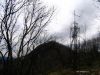
| Space Antennae site |
Marked on 1st edn Rendezvous Creek 1:25000 map. Site of numerous antennae as shown on CMA Rendezvous Creek 1:25 000, associated with the use of Orroral Tracking Station. |
Rendezvous Creek |
|
|
752 |
14 Dec 11* |
 |
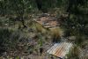
| Stockyard Creek Arboretum Hut site |
Built in about 1938 by Jack Newlyn. The hut was connected by phone to Bulls Head. A horse yard was erected in front of the hut. The hut blew down in the 1950s and today the site consists of fallen slabs and other timber, and some remnant corrugated met... (Source: KHA Namadgi database) |
Corin Dam |
|
|
299 |
30 Apr 13* |
 |
|
Stockyard Gap ski hut (ruin) |
See page 38 of Graeme Barrow's Namadgi & Tidbinbilla Classics: Tough Bushwalks
in Canberra's High Country:
"(...walk
westwards through scrub for a short distance at Stockyard Gap to reach
what's left of a hut (605645) built in 1948 by a group of Mt Franklin
skiers; scraps of bush and sawn timber and metal ridge-capping are all
that's left.)"
Built in 1948. Still standing in 1970s, the hut has now collapsed. Fallen timbers and the ridge-capping mark the site.
(Source: KHA Namadgi database) |
Corin Dam |
|
|
296 |
30 Apr 13*
|
 |
|
Stockyard beside Long Flat fire trail |
Adjacent to track from Mt Clear homestead to
Aboud's. Wire mesh on wooden uprights; post and rail race; wooden gates
(W-G T) |
Bredbo |
BR3 |
|
- |
30 Jul 13
25 Jul 09* |
 |
|
Stockyard on Naas Valley Fire Trail between Horse Gully Hut
and Demandering Hut |
In a
timbered saddle with no visible landmarks; 20m west of Naas-Mt Clear
track, contiguous with border of portions 14 and 32. Machine-sawn timber
wire bound into post and rail. |
Colinton |
BU2 |
|
287 |
29 Jan 09* |
 |
| Stockyards near Pheasant Hill (Grassy Creek Sheepyards) |
The
site is a substantially intact set of drop log sheep yards
with a concrete sheep dip. |
Yaouk |
B20 |
G39 |
285 |
23 Mar 13
28 Dec 10
20 Jul 10
13 Apr 10
24 Jun 08
18 Mar 08* |
 |
|
Stockyard overlooking Bulls Flat
Creek |
Six strand wire fences and tie wire droplog,
steel gates (in the 1970s). |
Yaouk |
B16 |
|
- |
24 Jun 08* |
 |
|
Stockyard site E of Smokers Trail |
Burnt out stockyard site |
Corin Dam |
|
|
271 |
6 Jan 09
23 Oct 04* |
 |
|
Stockyard site on Mt Tennent S fire trail |
Immediately adjacent ford on Booroomba Creek. |
Williamsdale |
NA5 |
|
- |
8 Jul 08* |
 |
| Survey mark above Bulls Flat FT |
Above W side Bulls Flat FT in tors |
Yaouk |
- |
- |
- |
31Aug-1Sep 13* |
 |
|
Tanks above Orroral Tracking
Station |
Marked on 1st edn map. Visible from Orroral Ridge opposite |
Rendezvous
Creek |
|
|
- |
14 Dec 11
27 May 08* |
 |
| Thomas Brayshaws Hut site |
Location from Steve B |
Yaouk |
- |
- |
- |
27 Sep 11* |
 |
|
Tin Dish School (ruin) |
Across the road from Brayshaw's hut, are the ruins of an
old school house. Known locally as the Tin Dish School, and
officially as the Bobeyan Subsidised School, it was a small one
roomed structure of weatherboards and iron. It was built by local
parents from materials from another school. Only squared blocks of
grey stone from the fire place remain. it opened for first term of
1907, operated for four terms of 1908 and 1909, then closed at the
end of the first term in 1910. William Gottaas was the teacher.
Children from the Dwyer, Perry, Westerman and Chalker families
attended, as their holdings were along nearby Grassy Creek. See
here . |
Shannons Flat |
BR9 |
G41 |
276 |
23 Mar 13
24 Jun 08
18 Mar 08* |
 |
|
Tong's Yard - site |
Stands in a cleared space on 1200m contour at a creek head 100m north of
the road to Tennent's peak. Now just a site. |
Williamsdale |
TH1 |
|
333 |
4 Dec 10
8 Sep 09* |
 |
|
Unnamed hut Pierces Creek Forest (ruin) |
Marked on 1st edn Cotter Dam 1:25000 map, not on 2nd edn |
Cotter Dam |
|
|
- |
20 May 08* |
 |
|
Unnamed hut Naas Valley (ruin) Tom Rolleys
Hut (via KS from MH material) |
Marked on 1st edn Michelago 1:25000 map, not on 2nd edn |
Michelago |
YA3 |
|
321 |
29 Jan 09
3 Jul 07* |
 |
| Unnamed hut site W of Old Boboyan Road (South) |
Now gone, this hut could possibly have been the home of the Woodfield family who lived in this area. The hut possibly was built after 1882 as it was not shown on the survey of that year. (Source: KHA database)
"Site marked by briar roses immediately adjacent west side of old Gudgenby road about 1km north of Naas ford." (W-G B12) |
Yaouk |
B12 |
|
885 |
19 Jul 11
5 Mar 11* |
 |
| Waterhole Hut |
Waterhole Hut was built by the then owner,
Thomas Oldfield, his son Jack and Henry Tyrie in 1939, to
support grazing. Stones were used from the old homestead
nearby, for the base to the chimney. the old homestead had
been occupied by Thomas Westerman's mother with her second
husband, Francis Dwyer. The stock yards nearby, are of note,
incorporating large granite boulders. See
here for KHA entry. See
here for entry in ACT Heritage Register. |
Yaouk |
B19 |
G38 |
261 |
31Aug-1Sep 13
23 Mar 13
8-9 Sep 12
15 Mar 11
28 Dec 10
20 Jul 10
13 Apr 10
24 Jun 08
18 Mar 08
8 May 07*
3-4 Jul 04 |
 |
| Waterhole Hut Stockyards |
'These stockyards were built by
Jack Oldfield and Alf Peters during the period 1935-39. They
were used to contain both sheep and cattle and represent one
of the most intact examples of pre-World War 2 stockyards in
Namadgi National Park and perhaps in the Australian high
country' signage at the site. |
Yaouk |
B18 |
|
330 |
31Aug-1Sep 13
23 Mar 13
8-9 Sep 12
28 Dec 10
13 Apr 10
24 Jun 08
18 Mar 08* |
 |
| Weather station - Cotter Hut Rd |
Weather station just off the Cotter Hut Rd 400m E of AAWT intersection |
Corin Dam |
- |
- |
- |
2 Jul 11* |
 |
| Weather station - Mt Franklin Rd |
Rain guage near the intersection of Stockyard Spur track and Mt Franklin Road |
Cotter Dam |
- |
- |
- |
28 Jun 11* |
 |
| Weather station - Naas Creek valley |
One of 4 weather stations installed by ACTPCS from late 1970s to mid 1980s. Not in use since 1992. Full GR is 675530 6033680. (Source: KHA NNP database) |
Yaouk |
- |
- |
256 |
19 Jul 11* |
 |
|
Weir - Condor Creek |
See Weirs. |
Cotter Dam |
|
|
163 |
13 May 08* |
 |
| Jim Westerman's Hut site |
Mentioned in the new (Jun10) Settlers Track brochure. Where/What is it? |
|
|
|
? |
|
|
|
Westermans Homestead |
This is a homestead, built in 1916
by Bruce Jeffery for grazing. It was originally occupied by
Selena Westerman and Bruce Jeffrey, and later by Selena's
parents, Thomas and Mary Westerman. It replaced a small mud
brick house with a shingle roof, which was placed about 50 m
to the south and a second house immediately behind this one.
The ruins remain visible. A Westerman baby and adult daughter
are buried nearby in a visible grave, up the hill from the
house. In the late 1990s, a team of KHA volunteers, led by
Maurie Sexton, spent many hundreds of hours restoring the
homestead to its original form. Mr Sexton received a well
earnt award from the ACT Heritage Commission, for this
restoration and that of Brayshaws. See
here for KHA entry. |
Shannons Flat |
B21 1-2 |
G44 |
262 |
23 Mar 13
15 Mar 11
28 Dec 10
20 Jul 10
13 Apr 10
24 Jun 08
18 Mar 08
8
May 07*
2
Oct 04 |
 |
|
Westermans grave |
The plaque says "In loving memory
of Elizabeth Mary Shiels loved daughter of Thomas & Mary Jane
(nee Perry) Westerman 21.10.1876 - 26.7.1922 also her brother
Baby Westerman died 1886. Erected by her relatives Jim
Crawford, Dolly Oldfield and Bill Osmond 1991". |
Shannons
Flat
|
B21 2-2 |
|
880 |
23 Mar 13
15 Mar 11
28 Dec 10
20 Jul 10
24 Jun 08
18 Mar 08* |
 |
| Westermans sheep dip |
|
|
|
|
712 |
28 Dec 10*
20 Jul 10 |
 |
|
Woolshed and Yards near S ACT border (site) |
Naas Road 20m west. |
Shannons
Flat |
BR14 |
|
- |
24 Jun 08* |
 |
|
Yards (near Cotter Hut) |
Marked on the Rendezvous Creek
1:25000 map as Yards, about 400m NW of Cotter Hut |
Rendezvous
Creek |
|
|
- |
7-8 Jun 08* |
 |
|
Yards (on Mt Ginini S spur) |
Adjacent to ski run SSW of Mt Ginini near
where Harrys Spur track goes W. Wire. |
Corin Dam |
|
|
184 |
5 Feb 11
21 Mar 09*
31 Jan 09 |
 |
| Yards (on Stockyard Spur above Snowy Flats) |
On Stockyard Spur above Snowy Flats. Wire. UTM 55H 662114-6064190 (GDA94) |
Corin Dam |
|
|
297 |
5 Feb 11
12 Jun 10
11 May 10
19 May 09
21 Apr 09
18 Apr 09
14 Apr 09
21 Mar 09
17 Mar 09* |
 |
| Yards (beside Old Boboyan Road (South)) |
Marked on 1st edn Yaouk 1:25000 topo map
"Yards as shown on CMA Yaouk 1:25 000." (Source: KHA datadase) There are, indeed, yards marked onthe 1st edn Yaouk map, but on the E side of the Old Boboyan Road. They are at UTM 55H 676985-6033697 (MGA94). Are these the same as W-G B14 at GR771338 (likely ADG66), which puts them on the Old Boboyan Rd around 500m N of the map marked spot?The sketch for B14 has the yards on the E side of the Old Boboyen Rd. I'd say yes. |
Yaouk |
B14 |
|
171 |
19 Jul 11
5 Mar 11* |
 |
| Yards (above Grassy Creek fire trail) |
Old yards site, first searched for by me with Rob H on 3 Sep 11, visited 27 Sep 11 |
Yaouk |
- |
- |
- |
27 Sep 11* |
 |
|
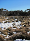
1 A circumspect source of information;
2 * = photo taken on this walk; 3 Sites of Significance in the ACT |
_t.jpg)


_t.jpg)
_t.jpg)

_t.jpg)


_t.jpg)


